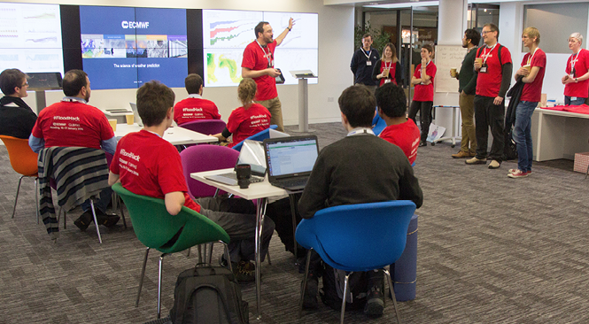
A meeting to improve the Global Flood Awareness System (GloFAS) through collaborative computer programming took place at ECMWF on 16 and 17 January. The ‘hackathon’ brought together more than 60 participants from research organisations, universities and industry. They worked on new ways to visualise GloFAS data, to make GloFAS more accessible and to create new downstream applications and products based on GloFAS data.
Global toll
Flooding has the highest frequency of occurrence of all types of natural disasters across the globe, accounting for 39% of all natural disasters since 2000. Flood events affect millions of people every year through displacement from homes, unsafe drinking water, destruction of infrastructure, and injury and loss of life. On average, each year more than 5,500 people are killed by floods and more than 94 million people are affected worldwide. Producing global forecasts of flood events has only become possible in recent years, due to the emergence of new developments and capabilities of forecasting systems; the integration of meteorological and hydrological modelling capabilities; improvements in data, satellite observations and land surface hydrology modelling; and increased resources and computer power.
ECMWF and GloFAS
ECMWF is developing the Global Flood Awareness System (GloFAS) in co-operation with the European Commission’s Joint Research Centre (JRC) and the University of Reading. GloFAS combines the Centre’s medium-range weather forecasts with a hydrological model to provide global forecasts of flood events. GloFAS users include national and regional water authorities, water resource managers, hydropower companies, civil protection and first line responders, and international humanitarian aid organisations.

Funding for global flood forecasts is limited, and GloFAS has essentially been created through the volunteer enthusiasm of a few individuals. Although we can now produce these forecasts, there is still a long way to go to make them usable, in particular for NGOs. The GloFAS system is currently used in a pilot project by the International Red Cross for forecast-based finance. The project recognises that, while forecasts may be available, there is often no humanitarian organization ready to act before a disaster strikes. Such anticipatory action can be far more effective than a post-disaster response. The pilot project will disburse humanitarian funding as soon as a forecast threshold is crossed and before a potential disaster occurs. However, for such projects to work, the system needs to be accessible to and usable by a wide range of individuals.
Tools that could save lives
The hackathon, organised by ECMWF and JRC staff in their spare time, took the form of a competition to help address these issues of accessibility and usability. After an introduction to GloFAS and brainstorming around challenges that need to be addressed, the participants were free to form teams and formulate a problem that could be solved within the available time. Five teams entered the competition and set out to create a prototype that would impress the judges in terms of its technical solution, its wow factor and innovation. The three winning entries were:
- LIVE (Logistic and Infrastructure Visual Evaluation): Using GloFAS forecast information to create a 'Time to respond' map. Sets out to summarise GloFAS forecast information into a 'Time to respond' prioritisation map that helps decision-making before and during a flood emergency. This is presented in a user-friendly way with key statistics which could support decision-making.
- FloodIT: Integrates (client-side) the GloFAS output with a higher-resolution Digital Elevation Model (DEM) map, increasing granularity of information for local areas. It provides more intuitive information based on the GloFAS output to help local users understand their situation.
- Interception – A Flood Awareness Education Platform: An educational game/online interactive platform to help inform people about what they should be doing when a flood watch/warning alert is issued in their region. The game/platform will also educate them on what to do during and after a flood event.
The #FloodHack page on ECMWF’s website has links to all the entries, along with photos from the weekend: http://tiny.cc/floodhack.
A big thank you to all participants who made this #FloodHack such a great success and who contributed with their ideas and skills to further improve GloFAS.
The #Floodhack was supported by the Copernicus Emergency Management Service – Early Warning Systems and the EarthServer-2 project (H2020, grant agreement No 654367).

