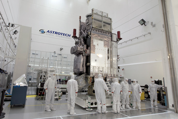

The advanced instruments on NOAA's Geostationary Operational Environmental Satellite-S (GOES-S) will provide meteorologists with high-resolution information about the weather below. (Photo credit: NASA/Leif Heimbold)
The 1st March 2018 will see the launch of a new geostationary satellite by the US National Oceanic and Atmospheric Administration (NOAA) and National Aeronautics and Space Administration (NASA). Geostationary Operational Environmental Satellite-S (GOES-S) will be the second in a series of new, advanced geostationary satellites designed to give higher resolution data, delivered more rapidly to forecasting centres such as ECMWF.
The launch of GOES-S (GOES-17) over the western US/Pacific Ocean will complete an important upgrade of the US geostationary observing system following the successful installation of GOES-R (GOES-16) over the Eastern US/Atlantic Ocean last year. Working together, GOES-S (GOES-17) and GOES-16 will be able to cover about half the planet, covering the western hemisphere from New Zealand to the west coast of Africa.
GOES-S will scan the Earth five times faster and at four times the image resolution of previous GOES satellites and will provide vivid imagery of hurricanes and other storms, snow, atmospheric motion and volcanic ash for example.
The sensor payload on-board this new generation of geostationary satellites is significantly improved compared to the old GOES instruments, the most important enhancement for meteorological applications being the Advanced Baseline Imager (or ABI).
The ABI will measure infrared and visible radiation in 16 spectral bands with a spatial resolution of just 2 km, providing a detailed three-dimensional view of temperature, wind and humidity that is unprecedented over the continental US (CONUS) region.
Even more remarkable is that the instrument is able to update this view of the CONUS region every 5 minutes or even every 30 seconds when directed at individual weather events (e.g. hurricanes). In addition to the ABI the new GOES satellites will also carry the first ever Geostationary Lightning Mapper (GLM), a highly sensitive optical instrument than can detect bursts of light from cloud-cloud and cloud-land electrical discharge. This will provide a real-time view of the location and intensity of severe convective storms.
The information from the new GOES satellites will contribute to ECMWF activities in three ways:
- Firstly, data on winds and humidity from the ABI coupled with information on convection from the GLM (assimilated via all-sky) will play a key role in ECMWF's monitoring and forecasting of weather over the US, including rapidly evolving severe events such as tropical cyclones and hurricanes.
- Secondly, upstream observations of the continental US and its eastern/western seaboards are crucial for medium-range forecasting over Europe, as many of the important weather systems that affect Europe have their origins in this region.
- Thirdly, a cornerstone of the ECMWF Strategy is evolving to higher spatial resolution as a pathway to improved forecast accuracy. This will require the analysis and modelling of small-scale atmospheric features which typically evolve quickly in time. The highly detailed and frequent observations from this new generation of geostationary spacecraft will play an important role in supporting this evolution.
Geostationary satellites remain at a fixed point over the Earth and so give a continuous picture of one segment of the globe. They complement polar orbiting satellites, which orbit the Earth’s Polar Regions and give a more detailed, but intermittent picture of a region.
The launch will take place on 1 March at 11.02 p.m. (Central European Time) from Cape Canaveral, Florida. There are four satellites in the GOES-R series: -R, -S, -T and -U, with the final satellite due to be launched in 2024.
