
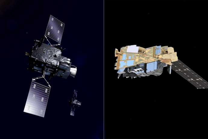
EUMETSAT is to launch new geostationary and polar-orbiting satellites over the next few years. (Images: ©EUMETSAT)
ECMWF needs up-to-date satellite observations of weather-related variables to initialise its forecasts and to conduct research. Its partnership with EUMETSAT is essential in this regard.
EUMETSAT will launch geostationary and polar-orbiting satellites over the next few years that provide some innovative capabilities, including the first infrared soundings from geostationary orbit.
EUMETSAT is also providing third-party access to data from Russian and Chinese satellites that occupy complementary orbits to US and European ones. ECMWF will use the data in its Integrated Forecasting System (IFS).
A new ECMWF activity is to simulate the impact of future constellations of small satellites EUMETSAT is considering, which would enable much more continuous coverage. And work is under way to use all channels of the main instrument on EUMETSAT’s polar-orbiting satellites.
“The next-generation of satellites that EUMETSAT will launch as of 2022 will provide ECMWF, and all our users, with a spectacular increase in the quality and variety of data accessible. From 6 PB at the moment, our archive will grow to 50 PB towards the end of 2025: all of which will support more accurate and useful Earth modelling and weather forecasting,” says Phil Evans, Director-General of EUMETSAT.
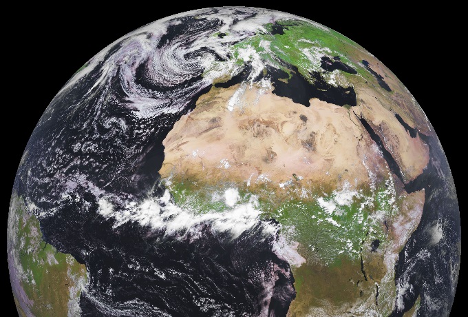
Meteosat imagery on 20 June 2021. (©EUMESAT 2021)
Meteosat Third Generation satellites
Geostationary satellites constantly observe a fixed, large, circular region of Earth from nearly 36,000 km above the equator.
ECMWF currently uses EUMETSAT’s Meteosat-11 over Europe and Africa, and Meteosat-8 centred over the Indian Ocean. They provide details of clouds and are used to produce wind products, in particular atmospheric motion vectors.
EUMETSAT video on Meteosat Third Generation satellites.
Meteosat Third Generation (MTG) satellites, which are to be launched in the next few years, will provide two additional elements.
The first is the infrared sounder (IRS), which will provide detailed 3D information on temperature and humidity every 30 minutes. Through humidity tracing, it will also give ECMWF wind information.
The second is the lightning imager, which will look at where lightning is taking place on Earth. This information can be used to determine where convection is taking place.
“This has to be on a geostationary satellite because you have to be viewing the scene constantly to pick up sporadic intermittent lightning flashes effectively,” ECMWF scientist Tony McNally says.
New polar-orbiting satellites
Polar-orbiting satellites observe different sections of Earth from a height of a few hundred kilometres while orbiting along a trajectory that includes the poles.
ECMWF uses EUMETSAT’s Metop-A, -B and -C satellites, which collect data from 817 km. From the mid-2020s it will benefit from Metop-Second Generation (SG) satellites scheduled to last until the 2040s.
EUMETSAT video on Metop-SG satellites.
The new instruments they carry include the Ice Cloud Imager (ICI). This sensor measures microwave radiation, particularly from frozen water particles.
“We already use microwave data, but this is of a kind we haven’t had before,” says Tony McNally, “in particular measuring parts of the spectrum which tells us about frozen water particles and will help us better understand the detailed physical processes at work in clouds.”
Like all satellite data, it will be useful for research into weather processes as well as numerical weather prediction operations.
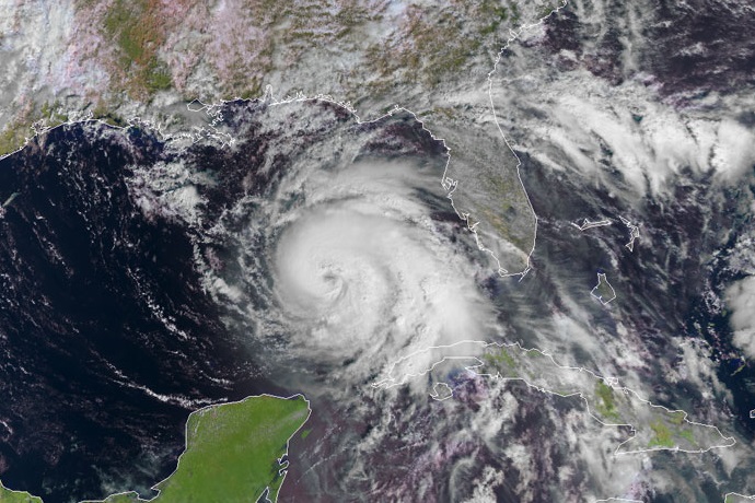
Hurricane Michael as seen by Metop-B on 10 October 2018. (©EUMETSAT 2021)
Russian and Chinese satellites
Russia and China have recently launched instruments that are of interest to ECMWF because in the future they will be carried by satellites in complementary orbits to US and European ones.
EUMETSAT has assisted in the acquisition and distribution of these data to provide them to ECMWF in close cooperation with those countries.
The Russian instrument is an infrared Fourier spectrometer for humidity and temperature profiles of the atmosphere. It is onboard the Meteor-M N2 satellite.
ECMWF currently assesses the data before using them in the data assimilation process.
“This is a significant contribution to ECMWF’s coverage of polar-orbiting satellites because they fill gaps in the current constellation,” Tony McNally says.
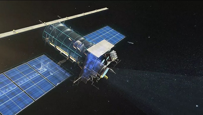
Russia’s Meteor-M N2 satellite. (Image: Russian Space Company)
More continuous coverage
There are big expectations for small EUMETSAT satellites to obtain additional data for weather forecasting.
A large constellation of small satellites could provide higher temporal sampling, collectively approaching that of ‘geostationary’ data. They would thus contribute to better observation of fast-evolving cloud and humidity features.
Small satellites are expected to become an important component of the future observing system and will complement the continued use of instruments on the larger satellite platforms.
In collaboration with ESA, ECMWF is currently investigating the optimal design for a future constellation of small satellites carrying microwave sounding instruments.
“Our aim is to make recommendations for the design that balance the benefit to numerical weather prediction with practicalities of instrument design and cost,” says ECMWF scientist Katie Lean. “In particular we are considering broad questions about the optimal number of satellites, their orbit type – polar or low inclination – and the relative advantages of humidity and temperature sensitivity.”
Using more instrument channels
Another area of research at ECMWF that is of interest to EUMETSAT is a bid to increase the number of channels used by hyperspectral infrared instruments, such as IASI.
IASI is the main Metop instrument. It provides information on the vertical structure of atmospheric temperature and humidity.
IASI data are taken on thousands of channels. For operational purposes, only a relatively small number of channels are selected and information from them is processed at ECMWF.
But with EUMETSAT’s support, the Centre is currently exploring a technique that would enable the use of all channels, which would be compressed mathematically.
“The reconstructed radiances approach is useful for the efficient representation of the hyperspectral infrared data, which will be of increased importance with more hyperspectral instruments, including from geostationary orbit,” says ECMWF scientist Cristina Lupu.
“By assimilating the full IASI long-wave and medium-wave spectrum via reconstructed radiances derived from truncated Principal Component scores, we can extract even more information from these observations," ECMWF scientist Marco Matricardi adds.
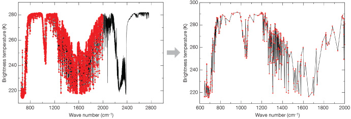
The diagrams show the result of compressing 5,421 IASI channels into 400 reconstructed radiances.
A close partnership
In addition to many activities that look to the future, ECMWF collaborates with EUMESAT on many current issues.
These include the Satellite Application Facilities (SAFs) funded by EUMETSAT to make sure the data produced by satellites is useable; the yearly EUMETSAT/SAF training course; and the EU-funded Earth observation Sentinel missions run by EUMETSAT.
“The close relationship with EUMETSAT is vital to our operational and research activities,” says Tony McNally. “It is a huge asset to both organisations.”
