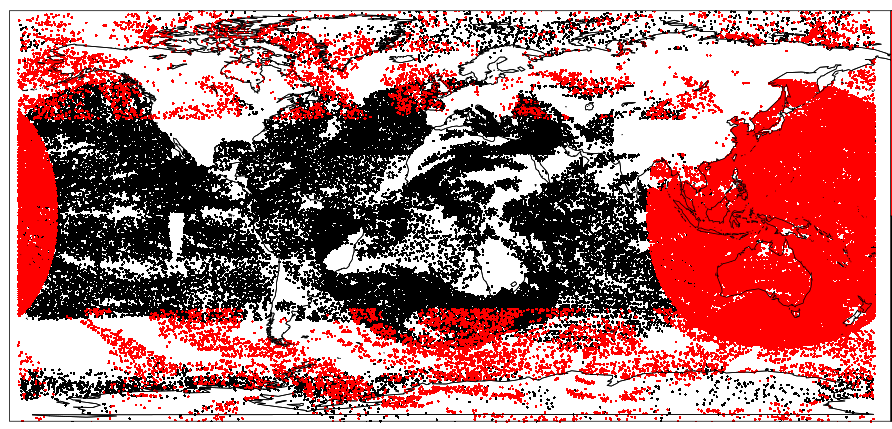
The first four months of this year saw a number of new satellite observations being assimilated operationally at ECMWF for the first time. These include observations from the geostationary satellite Himawari-8 over the Western Pacific region, winds derived from the AVHRR instrument on board the Metop polar-orbiting satellites, and new microwave radiances from the Chinese FY-3C polar-orbiting satellite. These additions include the first-ever use of some observational capabilities that have never before been available from space, and they reflect the constantly evolving satellite observing system.
Experiments show that the new data lead to a range of error reductions. These include reductions of about 1% in forecast errors of vector wind and geopotential height for some lead times and geographic locations. While such reductions may seem small, they have a significant cumulative effect, leading to an extension of the range of predictive skill.
Himawari-8
Himawari-8, which is operated by the Japan Meteorological Agency (JMA), is the successor of MTSAT-2. It carries the Advanced Himawari Imager (AHI), the most advanced imager currently in geostationary orbit. Compared to its predecessor, it provides up to two times higher spatial resolution; it is able to produce full-disk images over two times faster; and it has 16 rather than 5 channels. Himawari-8 data are assimilated at ECMWF in the form of Clear Sky Radiances (CSRs) from water vapour channels and Atmospheric Motion Vectors (AMVs) derived by tracking cloud structures in consecutive images. The data were activated on 12 January and 15 March 2016, respectively.
The Himawari-8 CSR assimilation benefits from the fact that for the first time three water vapour channels are available from geostationary orbit (compared to one for MTSAT-2), resulting in better discrimination of humidity structures in the vertical. This also facilitates the extraction of dynamical information through the tracing effect in ECMWF’s 4DVAR data assimilation system. In addition, the improved spatial resolution enables the use of a better cloud and aerosol mask. Tests show that assimilating Himawari-8 CSRs reduces forecast errors more than assimilating MTSAT-2 CSRs does.

The assessment of the Himawari-8 AMVs shows improved data quality compared to MTSAT-2, resulting from a combination of the new instrument capabilities and a completely revised derivation algorithm developed by JMA. There is a substantial increase in the number of available AMVs, including from some of the additional channels available. Early experiments tried to exploit the data available from the new channels, but mixed results led to choosing a selection that is similar to the previous MTSAT-2 configuration. This nevertheless leads to a very significant increase in the number of assimilated wind data, with some positive impact on wind forecasts. A second iteration which aims to further optimise and expand the data selection is under way.
Metop satellites
The introduction of the EUMETSAT-processed single and dual Metop AMVs on 4 February 2016 greatly increased the global AMV coverage, closing the gap that has traditionally existed between geostationary and polar AMVs (around 55–70°N/S). This has been made possible by deriving AMVs from the combination of the two AVHRR instruments available on the two Metop satellites that are flying in tandem, resulting in global coverage for the dual Metop product. In addition, EUMETSAT has introduced several changes to their polar AMV processing in recent years, and the long-term monitoring statistics indicate significant improvements in data quality. At high latitudes, the single and dual Metop AMVs now have characteristics similar to other AMVs, and the assimilation of the data poleward of 40°N/S has a positive impact on short-range and a neutral impact on longer-range forecasts. Enhancing the use of polar wind data in general is desirable, as some of the old polar AMVs have recently been lost.
FY-3C
Finally, the MicroWave Humidity Sounder-2 (MWHS-2) instrument carried by the Chinese polar-orbiting FY-3C satellite was activated in operations on 4 April 2016. This instrument combines traditional microwave humidity sounding capabilities at 183 GHz with new channels at 118 GHz, which have never before been available from space. The 118 GHz channels provide new information on temperature, humidity and cloud. We use the data in ECMWF’s all-sky system, continuing the pioneering work on the use of cloud-affected microwave radiances.
Trials show that assimilating 118 GHz channels improves short-range forecasts for low-level humidity and cloud in the southern hemisphere. The 183 GHz channels were also found to improve short-range humidity forecasts globally and vector wind day 3 forecast scores. The operational assimilation of MWHS-2 is another successful outcome of ECMWF’s fruitful collaboration with the Chinese Meteorological Administration (CMA) regarding the evaluation and assimilation of new Chinese satellite data. MWHS-2 is the second Chinese instrument to be activated at ECMWF, following on from the activation of the FY-3B MWHS humidity sounder in 2014.

