
Forty years ago a group of European nations resolved to join forces to improve numerical weather prediction.
Noting the "importance for the European economy of a considerable improvement in medium-range weather forecasts", they decided to set up ECMWF.
Today, the Centre has partnerships across all continents, collaborating at human, organisational and technological levels, and delivering a forecast that sets the international standard. The next 40 years should see even closer co-operation with our Member and Co-operating States, improved synergies with our partners across the world, and the drive to take on the great scientific challenges that lie ahead.
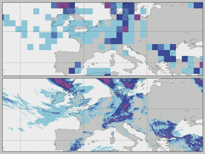
Since it was founded in 1975, the range of skilful weather predictions from ECMWF has increased from three days to nearly seven days ahead. One of the reasons behind this improvement is the finer spatial resolution at which the forecasting model is now run.
Numerical weather prediction divides the atmosphere into millions of grid boxes and uses the laws of physics to work out how conditions in those boxes change over time. Since 1979, the width of the grid boxes used at ECMWF has come down from 210 km to 16 km, and a 9-km resolution model is expected to be introduced in 2016.
These upgrades in horizontal resolution have made an important contribution to increasing the accuracy and detail in predictions.

These precipitation plots illustrate the increasing level of detail in ECMWF's predictions made possible by successive resolution upgrades.
