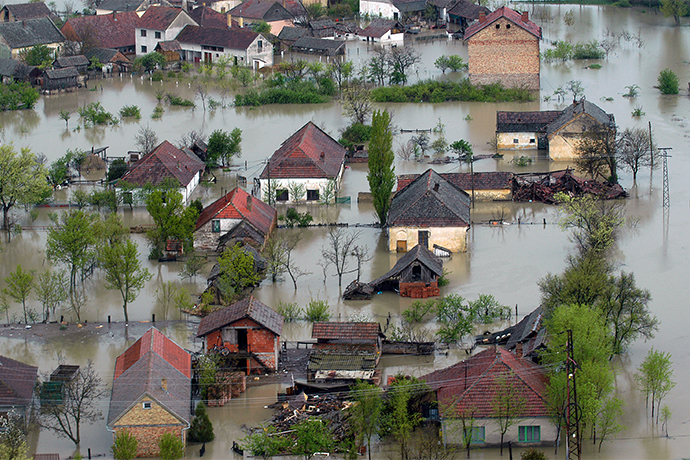

ECMWF’s weather forecasts feed into flood prediction systems that are part of the EU-funded Copernicus Emergency Management Service (CEMS). (Photo: SlobodanMiljevic/iStock/Thinkstock)
A recent EU herogram highlights the flood prediction work done at ECMWF to help the EU protect people from natural hazards. The Centre’s flood-related activities include research and operations.
The latest development is that in November ECMWF will release an operational global river discharge reanalysis. ECMWF scientists are also involved in a range of EU-funded flood-related research projects.
Herogram
A recent case study on the ‘EU Protects’ website features ECMWF scientist Fredrik Wetterhall as one of five ‘ordinary heroes’ who helped Ireland to prepare for floods that hit the country in winter 2015/16.
“Through the European Flood Awareness System, we share flood forecasts with governments and emergency services anywhere in Europe. In early December 2015, the EFAS centres sent multiple flash flood warnings to Ireland. These included details on when the storm would begin, when the maximum flood wave would pass through a certain area, and which cities would be most affected by flooding, such as Galway,” Fredrik said.

Fredrik Wetterhall is one of five ‘ordinary heroes’ featured in the case study on the EU Protects website.
ECMWF’s responsibilities in the area of flood prediction include running hydrometeorological computations, archiving data, and disseminating forecasts for the European and Global Flood Awareness Systems (EFAS and GloFAS).
ECMWF weather forecast data feed into EFAS and GloFAS, which are part of the EU-funded Copernicus Emergency Management Service (CEMS).
“We are constantly working to expand the portfolio of EFAS and GloFAS products for the benefit of European citizens and to support emergency response efforts across the world,” says ECMWF Environmental Forecasts Team Leader Christel Prudhomme. “In recent years, we have for example added seasonal EFAS forecasts, and we are currently developing a sub-seasonal to seasonal hydrometeorological forecasting system.”
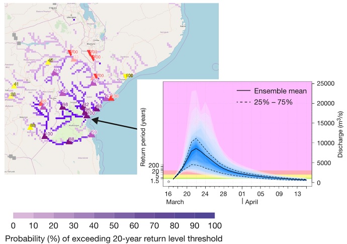
GloFAS proved its worth in March this year, during catastrophic flooding in Mozambique in the wake of tropical cyclone Idai: ECMWF scientists worked with the University of Reading, the University of Bristol, and the UK Government to support the international relief effort.

According to the UN, an estimated 1.85 million people were affected by Cyclone Idai in Mozambique. The river shading in the GloFAS map issued on 16 March 2019 shows the predicted probability of the streamflow exceeding the severe flood alert threshold (20-year return period) over the next 30 days, while the inset chart shows the predicted discharge evolution for the location indicated in the map.
GloFAS reanalysis
The next big development is the release of a GloFAS river discharge reanalysis, planned for 5 November.
“Such a global reanalysis is particularly important in areas with very limited or no in-situ observations of river discharge, so that patterns of droughts and floods can be better understood,” Christel notes.

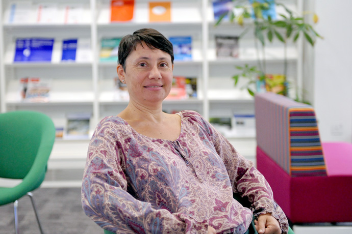
Christel Prudhomme leads a team of 13 scientists working on flood prediction and other weather-related applications.
The GloFAS reanalysis uses ECMWF’s ERA5 reanalysis of land surface runoff to drive a hydrological model to simulate daily river discharge for all the world’s rivers since 1979.
Once the dataset has been thoroughly checked, it will be made freely available in near-real-time through the Climate Data Store run by the EU-funded Copernicus Climate Change Service (C3S) implemented by ECMWF.
Projects
In addition to product development and operational forecasting, Christel’s team is active in a range of EU-funded research projects related to natural hazards. These include:
- ANYWHERE, which aims to enable society to respond more rapidly to extreme climate and weather events. ECMWF's role is to provide and develop forecasts of weather-related natural hazards, including floods, droughts and wildfires.
- IMPREX, which aims to improve society’s ability to anticipate and respond to future floods and droughts in Europe. ECMWF’s role includes contributing to seasonal hydrological risk outlooks.
- SMUFF, which aims to improve European flash flood forecasts up to five days ahead. A key challenge is to blend very short-range precipitation forecasts with the Centre’s longer-range ensemble forecasts to produce seamless flood impact risk information.
Team members are also involved in ground-breaking research. For example, a recent paper co-authored by ECMWF scientist Shaun Harrigan and published in the journal Nature shows for the first time that climate change increases river floods in northwest Europe and decreases floods in southern and eastern Europe.

Shaun Harrigan is part of an international team that studied the effect of climate change on European river floods.
Exploiting ECMWF’s weather expertise
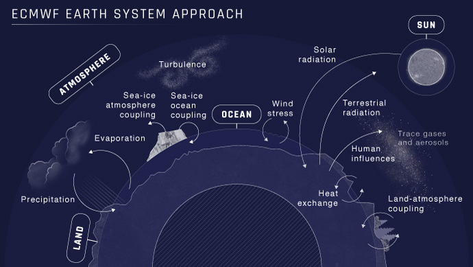
ECMWF’s work on floods and droughts is part of the Centre’s Earth system approach to modelling and predicting the weather and related aspects of the natural environment.
In addition to its contribution to CEMS, ECMWF is implementing C3S and the Copernicus Atmosphere Monitoring Service (CAMS).
“Our work on floods, climate and atmospheric composition is closely linked to our core work on global numerical weather prediction,” says Christel. “These activities help our Member States to provide vital environmental information services.”

ECMWF’s Earth system approach to forecasting aims to take into account all relevant Earth system components and their interactions.
